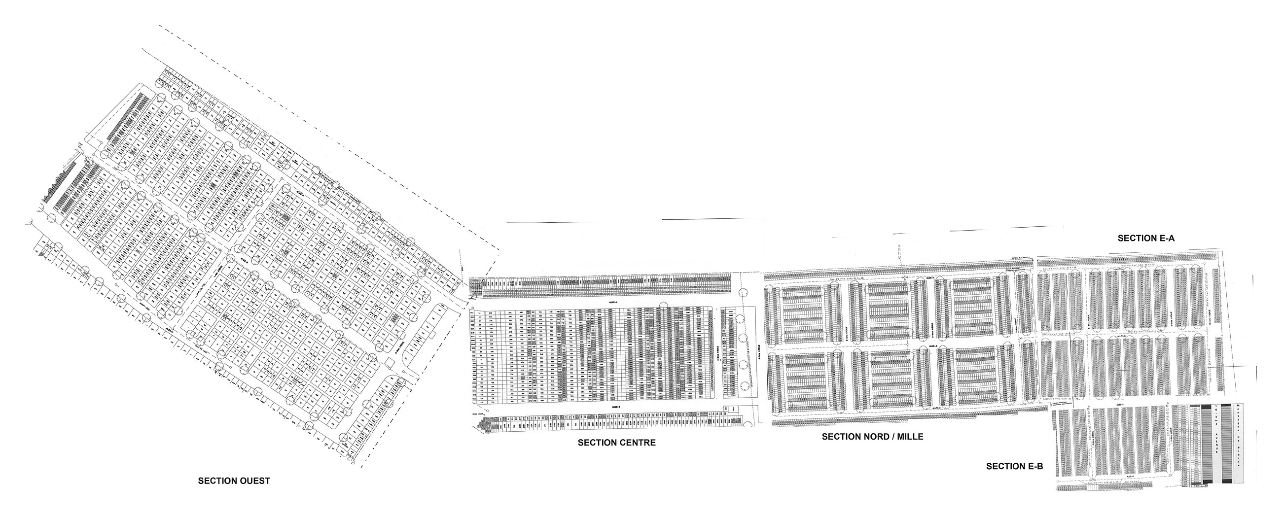
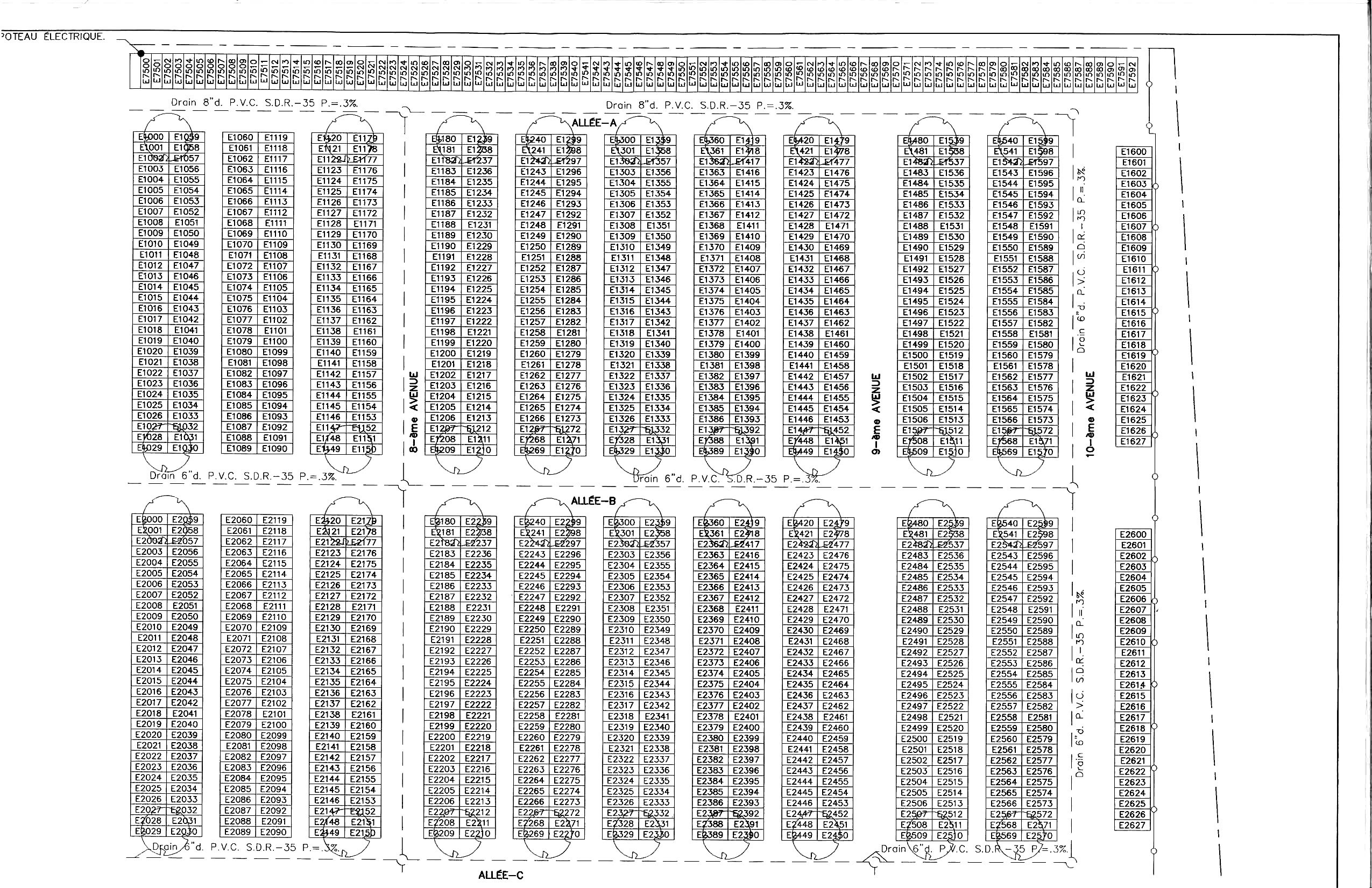
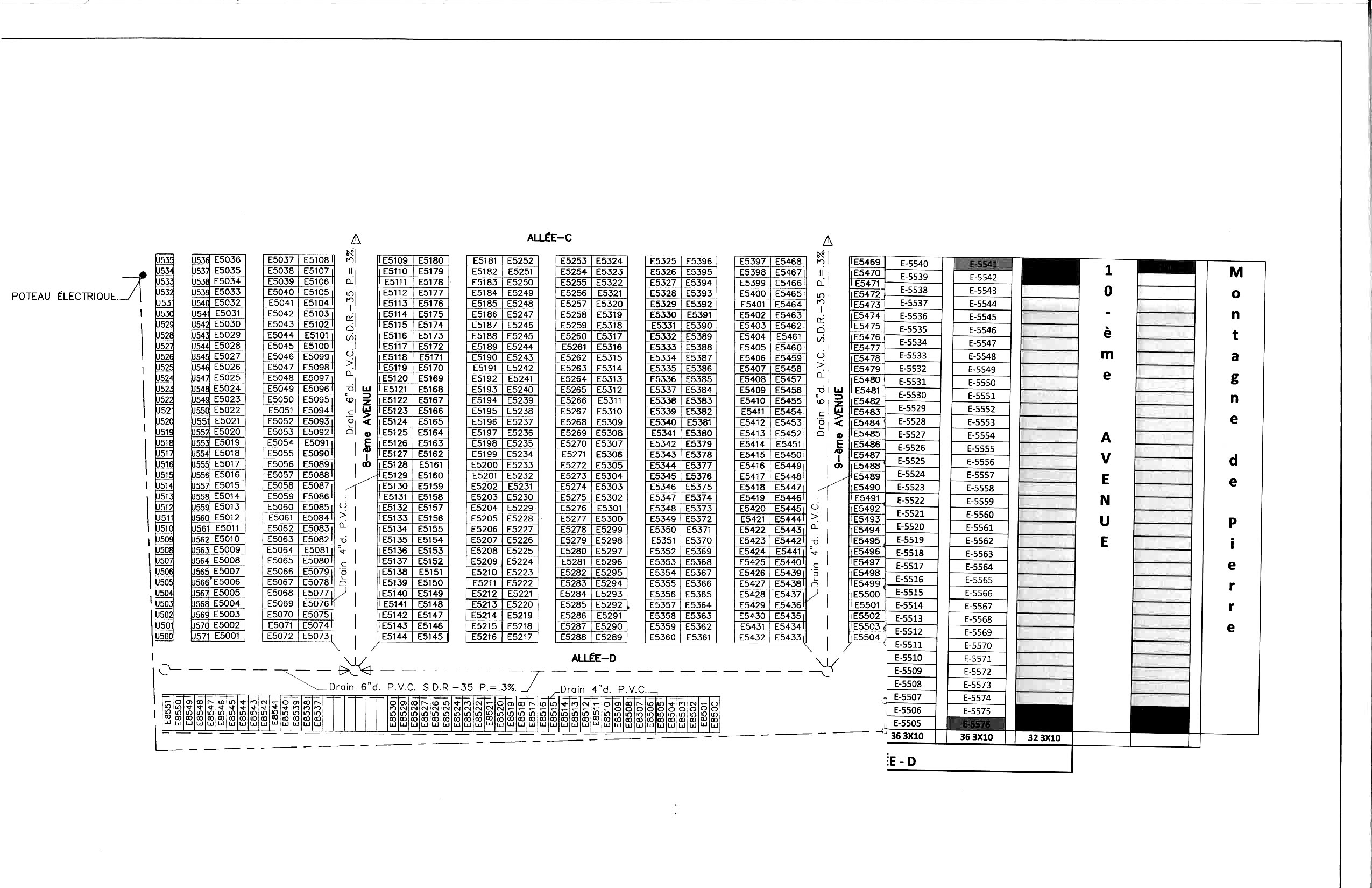
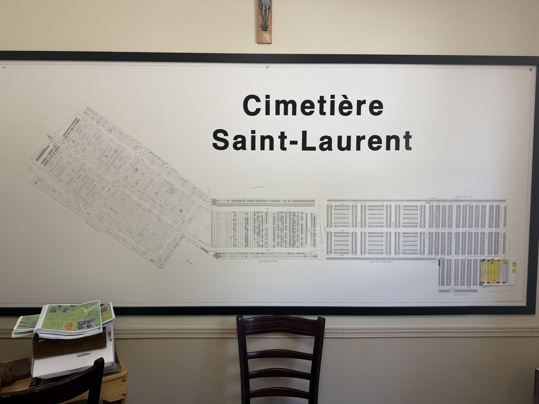
The cemetery is divided into five sections. The overall plan below reflects the real layout of the grounds; each section can then be viewed in detail.
Overall plan — the five sheets of the 2021 survey joined as they lie on the ground, like the office wall map.
Finding your way
The five sections
Click the plan to enlarge it, then drag to explore. On a phone, pinch to zoom.
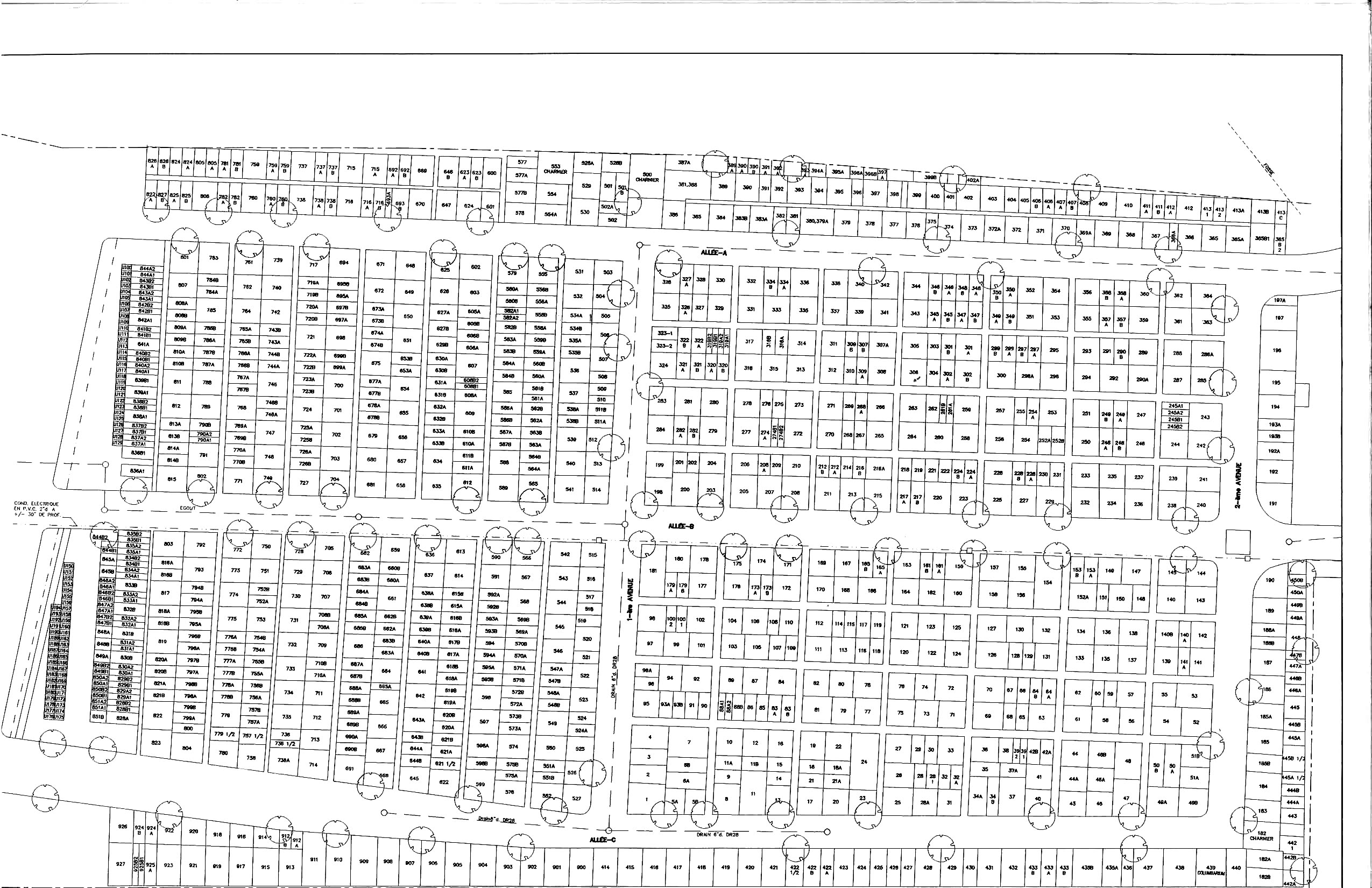
North-west, on a diagonal
Section Ouest
The oldest part of the cemetery, recognizable by its large monuments and irregular layout. It holds the charnel house and a columbarium. It is bordered by ALLÉE C, 1-ère AVENUE and 2-ème AVENUE.
Three-digit numbers with suffixes (826A, 844A2, 608B2), plus the U100–U129 and U150–U179 series.
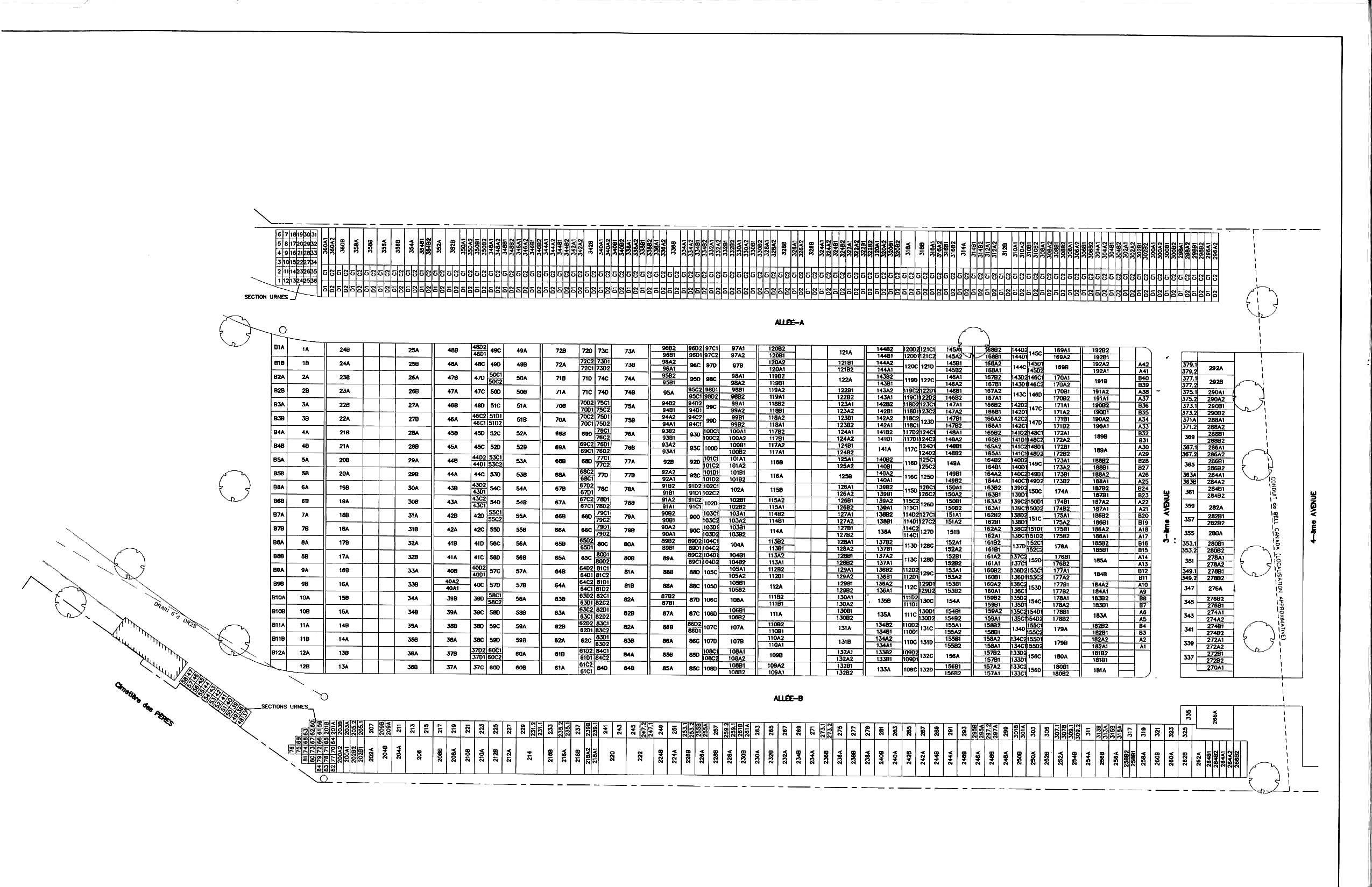
The middle of the grounds
Section Centre
Bordered to the north by ALLÉE-A and to the south by ALLÉE-B. It includes an area set aside for urns, the SECTIONS URNES, along its south-west edge.
Plot number followed by a quadrant code (A1, A2, B1, B2, C1, C2, D1, D2).
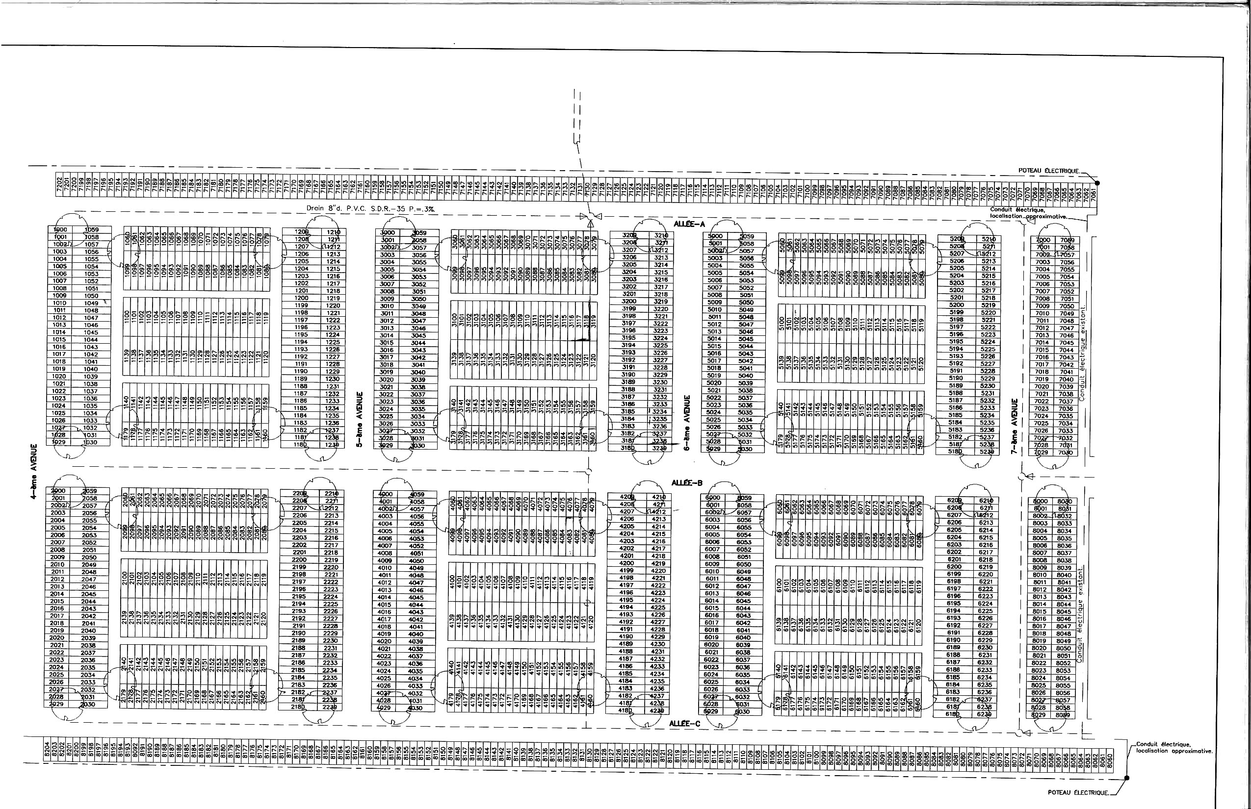
East of Section Centre
Section Nord / Mille
A modern section laid out in regular rows. Electrical conduit runs are marked along its north and south edges.
Four-digit numbers, roughly 1000 to 8200.
East end, northern part
Section E-A
A regular section bordered to the north by ALLÉE-A.
Plots E2000 to E2599, plus a row of E75xx plots.
East end, southern part
Section E-B
A section holding both burial plots and urn placements. It is crossed by 9-ème AVENUE, 10-ème AVENUE and ALLÉE-D, and includes the area known as "Montagne de Pierre".
Plots E5000 to E5600, the E8500 series, and urn placements U500 to U571.
At the office
The office wall map
The map displayed in the cemetery office, from which the five sheets above are drawn.